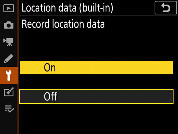
When [On] is selected for [Location data (built-in)] > [Record location data] in the camera setup menu, the camera will record the current longitude, latitude, altitude, and time (UTC, or Universal Coordinated Time) with each new picture taken. The location can be displayed on a map when the pictures are viewed in software such as ViewNX-i. Note that the camera continues to acquire location data even while off; to disable the location data feature, select [Off] for [Record location data].
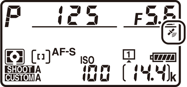
When the built-in location data feature is enabled, the strength of the signal from the global navigation satellite system (GNSS) providing the location data can be gauged via the icon in the top control panel:
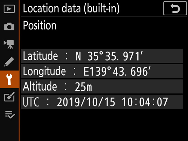
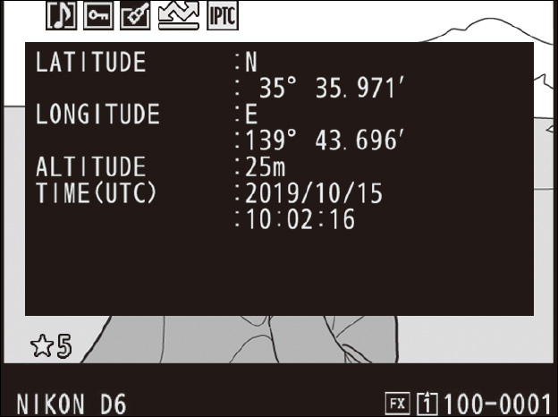
To view current location data, select [Location data (built-in)] > [Position].
To include location data in the photo info display, select [Shooting data] and [Detailed shooting data] > [Location data] for [Playback display options] in the playback menu.
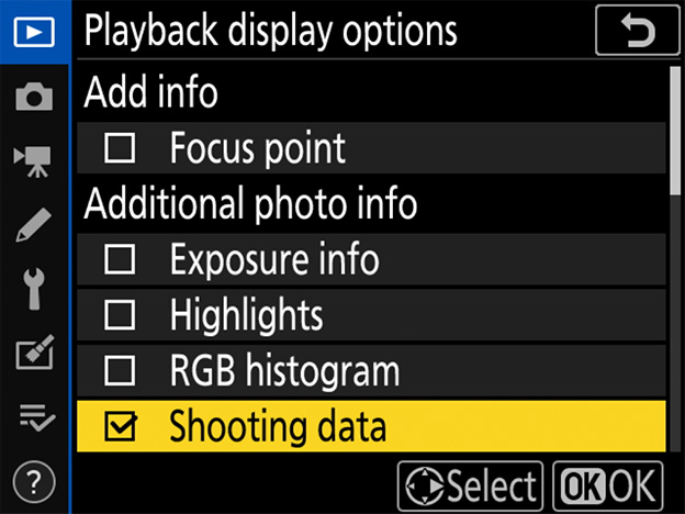
You can then press or in the photo info display to scroll to the location data page during playback.
Personal information may be inferred from pictures with embedded location data. Exercise caution when sharing photos, movies, or track logs or when posting them to the Internet or other locations where they can be viewed by third parties.
Location data provided by satellite navigation systems are accurate to within a few hundred meters. Depending on the accuracy of the data acquired and the effects of local topography on satellite reception, the location data recorded with pictures may differ from the actual location.
The camera may in certain cases need additional time to acquire location data, for example immediately after the battery is inserted, when the location data function is enabled for the first time, or after an extended period of disuse. The positions of navigation satellites are continuously changing, preventing or delaying the acquisition of location data in some locations or at certain hours of the day. In addition, the camera may be unable to receive location data or may report its location incorrectly indoors, underground, under bridges, or in tunnels, metal containers, or the vicinity of high-voltage transmission lines, large structures, trees, or other objects that block or reflect satellite signals. The presence of cellular telephones or other devices that produce magnetic fields or that cause radio noise or transmit on frequencies close to those of navigation satellites may also interfere with the acquisition of location data.
The location data recorded with movies are those reported at the start of recording.
Before travelling, check with your travel agent or the embassy or tourism board of the countries you will be visiting for information concerning restrictions on the recording of location data. China, for example, prohibits unauthorized recording of location data. Note that as of December, 2019, the location data function may not perform as expected in China and in the vicinity of the Chinese border.